CITATION
Thomas (T.L.) Tanton (1890-1971)
2022 ILSG Pioneer
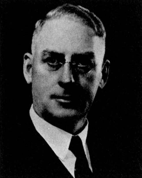
Thomas (T.L.) Tanton (1890-1971) was an eminent geologist who served in the Geological Survey of Canada (GSC) for over 40 years. A major focus of his work was the Precambrian geology and mineral resources of the Lake Superior region. He received his BA and MA degrees from the University of Toronto and his PhD from the University of Wisconsin under the guidance of C.K. Leith. Joining the GSC in 1915, he made a lasting contribution to the geology of Canada during his career, as represented in part by more than 40 reports, maps, and papers, many of them focusing on the geology of northwestern Ontario.
Dr. Tanton’s early work with the GSC involved reconnaissance surveys in northern Ontario. Working from bases on the railways, he delineated greenstone belts and other prospective areas. As an enthusiastic field geologist, he was a popular public servant who gave expert advice freely to prospectors, developers and others. Early reconnaissance work was followed by more systematic regional studies, particularly north and west of Lake Superior. A large part of this detailed, regional work culminated in several maps and reports, published from 1930 to 1940 (see below).
Dr. Tanton also made important contributions to the understanding of varied geological processes. He was involved with the debate on the age of the Coutchiching series of rocks, studied liquid immiscibility in Keweenawan rhyolites, and postulated on the origin of the Steep Rock Lake iron ore deposits, for example. He stimulated and encouraged those around him by his originality in approach and concepts, and his scientific peers and associates were challenged to re-examine accepted ideas and values. Dr. Tanton made a lasting contribution to the understanding of the geology of the Precambrian of Canada and particularly in many areas north and west of Lake Superior. He should merit consideration as a Pioneer of Lake Superior Geology.
[modified after a Memorial written by Gordon Gross in 1971].
Mark Smyk and Jim Miller
PERTINENT SELECTED PUBLICATIONS OF T.L. TANTON
1917
Reconnaissance along Canadian Northern Railway between Gogama and Oba, Sudbury and Algoma Districts, Ontario; Geological Survey Canada, Summary Report, 1916, p.179-182.
1918
Canadian Northern Railway between Nipigon and Longuelac, northern Ontario; Geological Survey Canada, Summary Report, 1917, pt. E, p.1-6.
1919
The Canadian National Railways between Longuelac and Oba, northern Ontario: Geological Survey Canada, Summary Report, 1918, pt. E, p. 1-3.
1920
Shore of Lake Superior between Port Arthur and Nipigon; Geological Survey Canada, Summary Report, 1919, pt. E, p.1-7 (contains map 1811 – lead- and zinc-bearing veins, Dorion Township and vicinity, Thunder Bay district).
Silver Islet and vicinity; Transactions Canadian Mining Institute, v.23, p.402-418.
1921
Thunder Bay district, Ontario: Geological Survey Canada, Summary Report, 1920, pt. D, p.1-2.
Nipigon - Schreiber district, Ontario: Geological Survey Canada, Summary Report, 1920, pt. D, p.2-7.
1922
An exploration north of Thunder Bay, Ontario; Geological Survey Canada, Summary Report, 1921, pt. D, p.1-5.
1923
Palladium-bearing nickel deposit at Shebandowan Lake, Thunder Bay district, Ontario; Geological Survey Canada, Summary Report, 1922, pt. D, p.1-8.
Gold occurrence at Makwa, Sudbury district, Ontario; Geological Survey Canada, Summary Report, 1922, pt. D, p.9-12.
The effect of glaciation on prospecting for mineral deposits in the Laurentian Plateau; Geography Review, v.13.
1924
Iron formation at Gravel Lake, Thunder Bay district, Ontario; Geological Survey Canada, Summary Report, 1923, pt. CI, p.1-5.
1925
Eastern part of Matawin Iron Range, Thunder Bay district, Ontario; Geological Survey Canada, Summary Report, 1924, pt. C, p.1-27, with Map 2069.
Evidence of liquid immiscibility in a silicate magma, Agate Point, Ontario; reprinted Journal of Geology, v.33, no.6, p.629-641, including tables, map, photos.
1926
Recognition of the Coutchiching near Steeprock Lake, Ontario; Royal Society of Canada, section IV, no.20, p.39.
1927
Mineral deposits of Steeprock Lake map area; Geological Survey Canada, Summary Report, 1925, pt. C, p.1-11.
Stratigraphy of the northern subprovince of the Lake Superior region; Geological Society of America, Bulletin, v.38, p.731-748.
1931
Fort William and Port Arthur, and Thunder Cape map areas, Thunder Bay district, Ontario; Geological Survey Canada, Memoir 167, with Maps 1902, 197A (surficial) and 276 A (see also Maps 198A, 203A, and 214A).
1932
Pearl (Ontario): in Manganese deposits of Canada Geological Survey Canada, Economic Geology Series, no. 12, p.102-104.
xv
Proceedings of the 68th ILSG Annual Meeting – Part 1
1933
Kenora sheet, Ontario: Geological Survey Canada, Map 266A, scale 1:506,880.
1934
Sturgeon River area, Thunder Bay district, Ontario: Geological Survey Canada, Map 312A, scale 1:126,720.
Little Long Lac area, Thunder Bay district, Ontario: Geological Survey Canada, Map 313A, scale 1:126,720.
1935
Copper - nickel occurrences in Pigeon River area, Ontario: Geological Survey Canada, Paper 35-1 (see Maps 354A, 355A, and 356A
1936
Mine Centre area, Rainy River district, Ontario: Geological Survey Canada, map 334A, scale 1:31,680.
Pigeon River area (sheet 1), Thunder Bay district, Ontario: Geological Survey Canada, map 354A, scale 1:63,360.
Pigeon River area (sheet 2), Thunder Bay district, Ontario: Geological Survey Canada, map 355A, scale 1:63,360.
Pigeon River area (sheet 3), Thunder Bay district, Ontario: Geological Survey Canada, map 356A, scale 1:63,360.
1938
Ignace sheet, southwest quarter, Kenora district, Ontario; Geological Survey Canada, Paper 38-13, scale 1:126,720 (see Map 557A).
Shebandowan area, Thunder Bay district, Ontario; Geological Survey Canada, Map 338A, scale 1:63,360.
Quetico sheet (east half), Thunder Bay and Rainy River districts; Geological Survey Canada, Map 432A , scale 1:253,440.
1939
Quetico (west half), Rainy River district, Ontario: Geological Survey Canada, Map 534A, scale 1:253,440.
1941
Origin of the hematite deposits at Steeprock Lake, Ontario; Royal Society of Canada, series 3, section 4, v.35, p.131-141.
Areas in the vicinity of Steeprock Lake, Rainy River district, Ontario (Summary account); Geological Survey Canada, Paper 41-13; scale 1:2,400 and 1:6,000.
1946
The iron ore at Steeprock Lake; Reprint from Royal Society of Canada, Transactions, series 3, section 4, v.40, 9p.
1948
New Helen Mine: in Structural geology of Canadian ore deposits: a symposium; Canadian Institute of Mining and Metallurgy, p.422-428.
Radioactive nodules in sediments of the Sibley series, Nipigon, Ontario; Royal Society of Canada, Transactions, series 3, section 4, v.42, p.69-75.
An occurrence of boron minerals at Silver Harbour, Lake Superior; Royal Society of Canada, Transactions, series 3, section 4, May 1948, p.77-79.